Eagle, Colorado
Eagle, Colorado | |
|---|---|
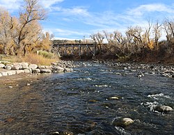
 The Eagle River flows through Chambers Park in Eagle | |
| Motto: “Classic Colorado” | |
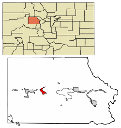
 Location of the Town of Eagle in Eagle County, Colorado. | |
Location of the Town of Eagle in the United States. | |
| Coordinates: 39°37′56″N 106°49′12″W / 39.63222°N 106.82000°W[2] | |
| Country | |
| State | |
| County | Eagle County seat[1] |
| Incorporated (town) | April 5, 1905[3] |
| Government | |
| • Type | Home rule municipality[1] |
| • Mayor | Scott Turnipseed[citation needed] |
| • Town Manager | Brandy Reitter[citation needed] |
| Area | |
• Total | 5.661 sq mi (14.663 km2) |
| • Land | 5.641 sq mi (14.611 km2) |
| • Water | 0.020 sq mi (0.052 km2) |
| Elevation | 6,683 ft (2,037 m) |
| Population | |
• Total | 7,511 |
| • Density | 1,331/sq mi (514/km2) |
| • Metro | 55,731 |
| • CSA | 134,774 |
| Time zone | UTC−07:00 (MST) |
| • Summer (DST) | UTC−06:00 (MDT) |
| ZIP code[5] | 81631 (PO Box) |
| Area code | 970 |
| INCITS place code | 0822200 |
| GNIS feature ID | 2412456[2] |
| FIPS code | 08-22200 |
| Website | www |
Eagle is the home rule municipality that is the county seat of Eagle County, Colorado, United States.[1][6] The town population was 7,511 at the 2020 United States census, a +15.41% increase since the 2010 census.[4] Eagle is the part of the Edwards, CO Micropolitan Statistical Area.
The town has an extensive trail system for mountain biking, hiking and trail running.[7][8]
History
[edit]A post office called Eagle has been in operation since 1891.[9] The town takes its name from Eagle County, which itself takes its name from the Eagle River.[10] Eagle was incorporated in 1905.[3]
Geography
[edit]
Eagle is located west of the center of Eagle County in the valley of the Eagle River, a west-flowing tributary of the Colorado River. The town limits extend southward up the valley of Brush Creek. U.S. Route 6 passes through the center of town, and Interstate 70 passes through the northern side, with access from Exit 147. Vail is 30 miles (48 km) to the east, and Glenwood Springs is 31 miles (50 km) to the west.
At the 2020 United States Census, the town had a total area of 3,623 acres (14.663 km2) including 13 acres (0.052 km2) of water.[4]
Climate
[edit]The climate of Eagle is characterized by cold winters, hot summers, and relatively little precipitation. Under the Köppen climate classification, Eagle has a warm-summer humid continental climate (Dfb), but it is borderline semi-arid (BSk) due to low rainfall. As a consequence of the city's high elevation, temperatures drop sharply after sunset.
| Climate data for Eagle County Regional Airport, Colorado (1981–2010 normals, extremes 1904–present)[11] | |||||||||||||
|---|---|---|---|---|---|---|---|---|---|---|---|---|---|
| Month | Jan | Feb | Mar | Apr | May | Jun | Jul | Aug | Sep | Oct | Nov | Dec | Year |
| Record high °F (°C) | 58 (14) |
65 (18) |
73 (23) |
82 (28) |
90 (32) |
100 (38) |
99 (37) |
96 (36) |
93 (34) |
84 (29) |
73 (23) |
61 (16) |
100 (38) |
| Mean daily maximum °F (°C) | 32.4 (0.2) |
37.9 (3.3) |
47.2 (8.4) |
56.6 (13.7) |
67.3 (19.6) |
77.6 (25.3) |
83.1 (28.4) |
81.5 (27.5) |
72.7 (22.6) |
60.3 (15.7) |
44.4 (6.9) |
32.8 (0.4) |
57.8 (14.3) |
| Mean daily minimum °F (°C) | 10.1 (−12.2) |
16.8 (−8.4) |
25.8 (−3.4) |
31.0 (−0.6) |
38.3 (3.5) |
44.3 (6.8) |
51.3 (10.7) |
50.5 (10.3) |
42.1 (5.6) |
31.8 (−0.1) |
21.9 (−5.6) |
12.5 (−10.8) |
31.4 (−0.4) |
| Record low °F (°C) | −51 (−46) |
−46 (−43) |
−20 (−29) |
−15 (−26) |
5 (−15) |
12 (−11) |
29 (−2) |
26 (−3) |
14 (−10) |
2 (−17) |
−29 (−34) |
−33 (−36) |
−51 (−46) |
| Average precipitation inches (mm) | 0.45 (11) |
0.54 (14) |
0.78 (20) |
1.17 (30) |
0.97 (25) |
0.74 (19) |
1.49 (38) |
0.82 (21) |
1.43 (36) |
1.24 (31) |
0.90 (23) |
0.78 (20) |
11.31 (287) |
| Average snowfall inches (cm) | 6.5 (17) |
7.3 (19) |
5.4 (14) |
3.6 (9.1) |
1.1 (2.8) |
0 (0) |
0 (0) |
0 (0) |
0.3 (0.76) |
2.8 (7.1) |
8.0 (20) |
11.7 (30) |
46.7 (119) |
| Average precipitation days (≥ 0.01 in) | 5.6 | 6.9 | 8.2 | 7.5 | 8.9 | 5.9 | 10.8 | 8.9 | 8.3 | 7.2 | 8.1 | 7.6 | 93.9 |
| Average snowy days (≥ 0.1 in) | 5.4 | 6.3 | 5.9 | 3.2 | 0.6 | 0 | 0 | 0 | 0.1 | 1.4 | 5.7 | 7.4 | 36.0 |
| Source: NOAA,[12][13] Western Regional Climate Center[14] | |||||||||||||
Demographics
[edit]| Census | Pop. | Note | %± |
|---|---|---|---|
| 1900 | 124 | — | |
| 1910 | 186 | 50.0% | |
| 1920 | 358 | 92.5% | |
| 1930 | 341 | −4.7% | |
| 1940 | 518 | 51.9% | |
| 1950 | 445 | −14.1% | |
| 1960 | 546 | 22.7% | |
| 1970 | 790 | 44.7% | |
| 1980 | 950 | 20.3% | |
| 1990 | 1,580 | 66.3% | |
| 2000 | 3,032 | 91.9% | |
| 2010 | 6,508 | 114.6% | |
| 2020 | 7,511 | 15.4% | |
| U.S. Decennial Census | |||
As of the 2010 census, there were 6,508 people, 2,183 households, and 1,666 families residing in the town. The population density was 1,417.9 inhabitants per square mile (547.5/km2). There were 2,416 housing units at an average density of 526.4 units per square mile (203.2 units/km2). The racial makeup of the town was 87.3% White, 0.4% African American, 0.8% Native American, 0.8% Asian, 0.02% Pacific Islander, 7.9% some other race, and 2.6% from two or more races. Hispanic or Latino of any race were 22.3% of the population.[15]
There were 2,183 households, out of which 49.5% had children under the age of 18 living with them, 65.5% were headed by married couples living together, 6.7% had a female householder with no husband present, and 23.7% were non-families. 16.3% of all households were made up of individuals, and 4.1% were someone living alone who was 65 years of age or older. The average household size was 2.96 and the average family size was 3.33.[15]
In the town, the population was spread out, with 31.7% under the age of 18, 5.8% from 18 to 24, 35.8% from 25 to 44, 22.7% from 45 to 64, and 4.1% who were 65 years of age or older. The median age was 33.8 years. For every 100 females, there were 104.5 males. For every 100 females age 18 and over, there were 102.9 males.[15]
For the period 2010–14, the estimated median annual income for a household in the town was $81,571, and the median income for a family was $94,875. Male full-time workers had a median income of $65,156 versus $47,902 for females. The per capita income for the town was $35,426. About 2.0% of families and 4.2% of the population were below the poverty line, including 2.8% of those under age 18 and 28.2% of those age 65 or over.[16]
Community activism
[edit]The Eagle community has an involved community, especially when big issues come up for review. In just three years, there were three referendums. In January 2010, voters defeated a 582,000-square-foot (54,100 m2) lifestyle center project called Eagle River Station. In January 2012, voters approved allowing the medical marijuana dispensary to stay in business. (The board of trustees originally allowed the business to open but then the new board of trustees decided to withdraw that permit. The owners of the marijuana dispensary then took it to the vote of the people and the business was allowed to stay open.) In May 2012, voters approved the second vote on the now 732,000-square-foot (68,000 m2) lifestyle center project still called Eagle River Station.
Transportation
[edit]Eagle County Regional Airport (IATA:EGE, ICAO:KEGE) is 5 miles (8 km) to the west, located between Eagle and the town of Gypsum. Many airlines provide services from Eagle to various destinations during the ski season months, although in the low season months the airport just has services to Dallas and Denver. ECO Transit provides local transportation from Eagle to Dotsero, Gypsum, Edwards, Avon and Vail.
 Interstate 70 runs east–west connecting the town to Baltimore, Maryland, on its east end, passing through Columbus, Indianapolis, Saint Louis, Kansas City, and Denver, and ends at Interstate 15 in Utah.
 U.S. Highway 6 parallels Interstate 70 in Eagle County, running east–west from Provincetown, Massachusetts, to Bishop, California.
Union Pacific Railroad's tracks cross Eagle, linking the town to Denver, Grand Junction, and Pueblo. The closest Amtrak station is located in Glenwood Springs, 31 miles (50 km) to the west, with daily service of the California Zephyr.
Bustang, Colorado's state-run bus service, connects Eagle to both Grand Junction and Denver.[17]
Education
[edit]Eagle is home to two elementary schools and a middle school:
- Brush Creek Elementary School
- Eagle Valley Elementary School
- Eagle Valley Middle School
Eagle Valley High School, located in the neighboring town of Gypsum, serves the students of Eagle.
Notable residents
[edit]- Benjamin Kunkel (born 1972), novelist and political economist
See also
[edit]References
[edit]- ^ a b c d "Active Colorado Municipalities". Colorado Department of Local Affairs. Retrieved July 11, 2024.
- ^ a b c U.S. Geological Survey Geographic Names Information System: Eagle, Colorado
- ^ a b "Colorado Municipal Incorporations". State of Colorado, Department of Personnel & Administration, Colorado State Archives. December 1, 2004. Retrieved September 2, 2007.
- ^ a b c d "Decennial Census P.L. 94-171 Redistricting Data". United States Census Bureau, United States Department of Commerce. August 12, 2021. Retrieved September 7, 2021.
- ^ "ZIP Code Lookup". United States Postal Service. Archived from the original (JavaScript/HTML) on November 4, 2010. Retrieved September 8, 2007.
- ^ "Find a County". National Association of Counties. Archived from the original on July 12, 2012. Retrieved June 7, 2011.
- ^ "Profile for Eagle, Colorado, CO". ePodunk. Retrieved September 7, 2012.
- ^ "Eagle, Colorado". City-Data.com. Retrieved September 7, 2012.
- ^ "Post offices". Jim Forte Postal History. Archived from the original on March 6, 2016. Retrieved June 25, 2016.
- ^ Dawson, John Frank. Place names in Colorado: why 700 communities were so named, 150 of Spanish or Indian origin. Denver, CO: The J. Frank Dawson Publishing Co. p. 19.
- ^ Large swaths of data are missing; in particular, precipitation and snow data from July 1994 onward is largely missing. For more information, consult either the WRCC or NOAA source provided.
- ^ "National Weather Service Climate". National Oceanic and Atmospheric Administration. Retrieved March 29, 2014.
- ^ "Station Name: CO EAGLE FAA AP". National Oceanic and Atmospheric Administration. Retrieved March 29, 2014.
- ^ "Seasonal Temperature and Precipitation Information". Western Regional Climate Center. Retrieved March 24, 2013.
- ^ a b c "Profile of General Population and Housing Characteristics: 2010 Census Summary File 1 (DP-1): Eagle town, Colorado". American Factfinder. U.S. Census Bureau. Archived from the original on February 13, 2020. Retrieved January 22, 2016.
- ^ "Selected Economic Characteristics: 2010-2014 American Community Survey 5-Year Estimates (DP03): Eagle town, Colorado". American Factfinder. U.S. Census Bureau. Archived from the original on February 13, 2020. Retrieved January 22, 2016.
- ^ "Bustang Schedules". RideBustang. CDOT.


